This function identifies which sub-basin a set of latitude and longitude points belong to, using a user-specified or default shapefile.
The default shapefile includes the Baltic Sea, Kattegat, and Skagerrak basins and is included in the iRfcb package.
Arguments
- latitudes
A numeric vector of latitude points.
- longitudes
A numeric vector of longitude points.
- plot
A boolean indicating whether to plot the points along with the sea basins. Default is FALSE.
- shape_file
The absolute path to a custom polygon shapefile in WGS84 (EPSG:4326) that represents the sea basin. Defaults to the Baltic Sea, Kattegat, and Skagerrak basins included in the
iRfcbpackage.
Details
This function reads a pre-packaged shapefile of the Baltic Sea, Kattegat, and Skagerrak basins from the iRfcb package by default, or a user-supplied
shapefile if provided. The shapefiles originate from SHARK (https://shark.smhi.se/en/). It sets the CRS, transforms the CRS to WGS84 (EPSG:4326) if necessary, and checks if the given points
fall within the specified sea basin. Optionally, it plots the points and the sea basin polygons together.
Examples
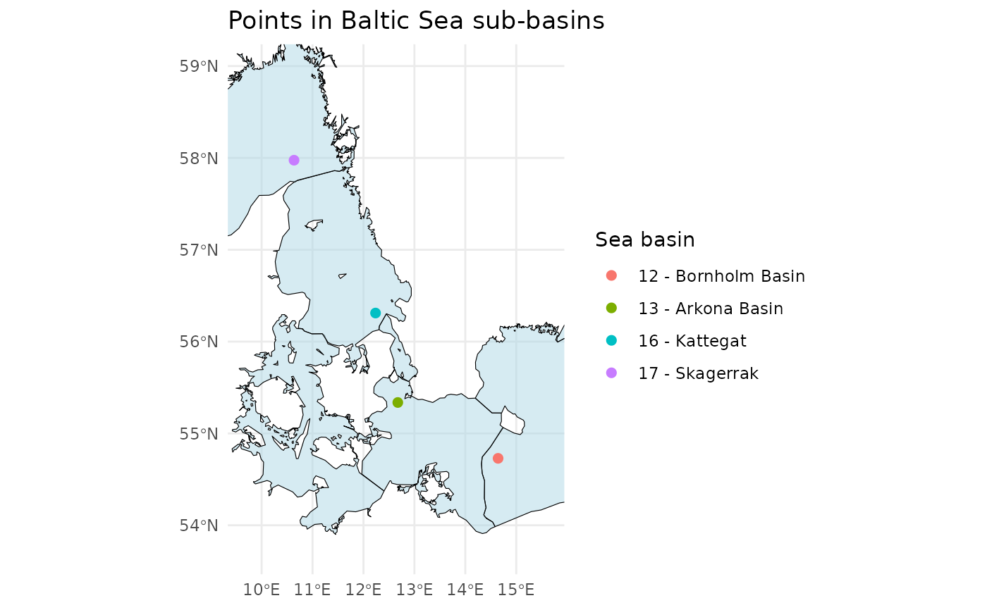
# Define example latitude and longitude vectors
latitudes <- c(55.337, 54.729, 56.311, 57.975)
longitudes <- c(12.674, 14.643, 12.237, 10.637)

# Check in which Baltic sea basin the points are in
points_in_the_baltic <- ifcb_which_basin(latitudes, longitudes)
print(points_in_the_baltic)
#> [1] "13 - Arkona Basin"   "12 - Bornholm Basin" "16 - Kattegat"
#> [4] "17 - Skagerrak"

# Plot the points and the basins
ifcb_which_basin(latitudes, longitudes, plot = TRUE)